American Rides
Route Maps
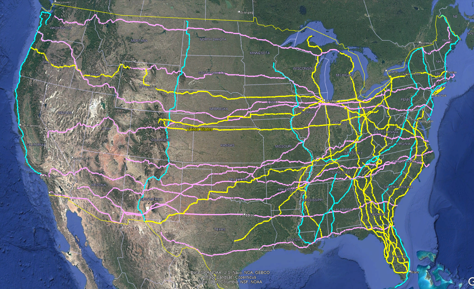
See the American Rides highway network by direction: North to South, South to North, East to West, and West to East.
Routes Included
US 1 | US 2 | US 6 | US 9 | US 11 | US 14 | US 17 | US 19 | US 20 | US 23 | US 27 | US 30 | US 33 | US 34 | US 36 | US 41 | US 43 | US 49 | US 60 | US 61 | US 62 | US 64 | US 66 | US 68 | US 70 | US 79 | US 80 | US 85 | US 90 | US 101 | US 301 | US 441
🚴♂️ American Bike Journey — Virtual Rides with Kevin Murphy 🚴♂️
🌟 The Road Ahead
📅 Journey started: 2021
Project Snapshot
💥 33 U.S. highway routes planned
💥 51,834 total mapped miles
This grand journey is about more than covering the miles across America. From the misty coasts of Maine on US 1 to the winding beauty of the Pacific on US 101, and through the heartlands of US 20, every ride is an invitation to embrace the road.
The routes span from the Atlantic to the Pacific, from Maine to Florida, and across the American heartland.
The goal is not the finish line—it is the freedom of the ride, the richness of the experiences, and the challenge each mile brings. NordicTrack’s virtual experience makes this possible, turning every ride into a celebration of landscapes, history, and discovery.
🌟 Every mile is part of the journey, not just the finish line.
🌟 It is not about getting there. It is about going there.
American Highways
Explore the highways that define the American horizon:
🌞 US 1 — North to South — Completed
Miles: 2,384 — Completed: 2025
U.S. 1 stretches from the rugged wilderness of Fort Kent, Maine, to the sun‑soaked paradise of Key West, Florida. Along the way, it passes rocky New England coastlines, bustling Mid‑Atlantic cities, and the warm beaches of the Carolinas before reaching the subtropics of Florida.
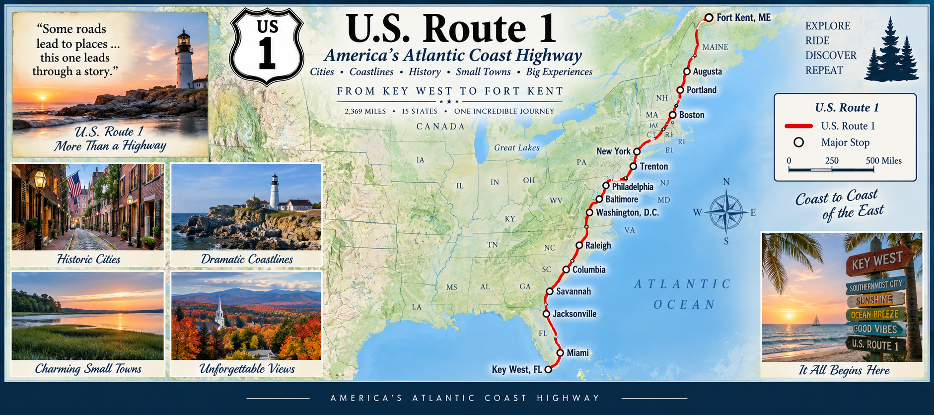
This route captures the diversity and charm of the eastern United States — a vibrant blend of history, culture, and natural beauty. From Boston’s Freedom Trail to the Chesapeake Bay and on to the Keys, every section tells its own story. It’s a journey that’s always on my horizon — sometimes ahead, sometimes in the rearview mirror.
🌄 US 2 — Across America’s Northern Tier
Miles: 2,575 — Status: In Progress
The eastern segment runs through New England and Upstate New York, passing forests, lakes, and historic towns. The western segment stretches from Minnesota across the northern plains, through Montana’s rugged mountains, and into the evergreen beauty of Washington State.
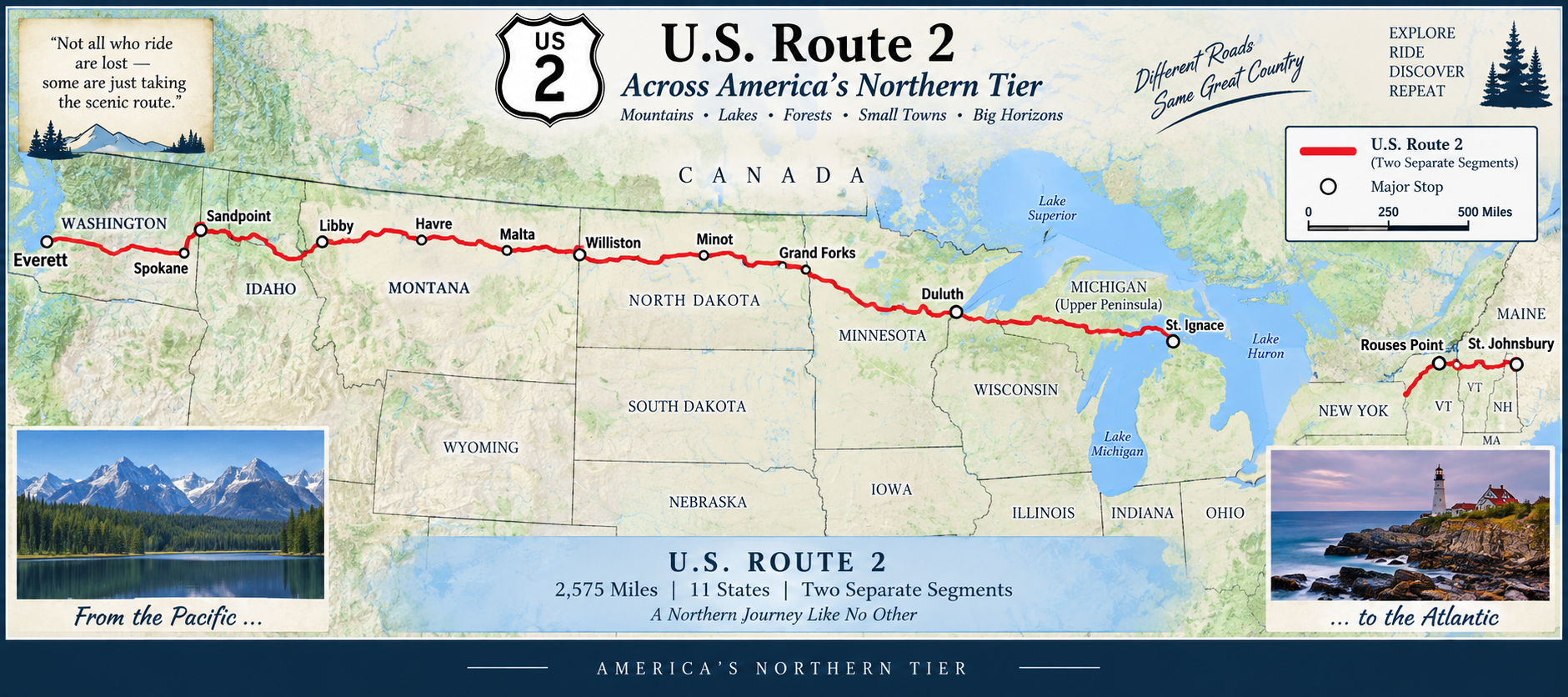
U.S. 2 is one of America’s most unusual highways — a transcontinental route split into two completely separate segments by Lake Michigan. Despite the break, the combined mileage makes US 2 comparable in length to US 6 and US 20, and it spans some of the most scenic landscapes in the northern United States.
Together, these two halves form a single story — a northern journey across America’s roofline, from Atlantic charm to Pacific wilderness.
🛣️ US 6 — The Grand Army of the Republic Highway
Miles: 3,200— Status: In Progress
U.S. 6 is one of America’s great cross‑country highways — stretching from the tip of Cape Cod in Provincetown, Massachusetts, all the way to the Sierra Nevada in Bishop, California. Once the longest highway in the United States, US 6 still carries the spirit of a true coast‑to‑coast journey.
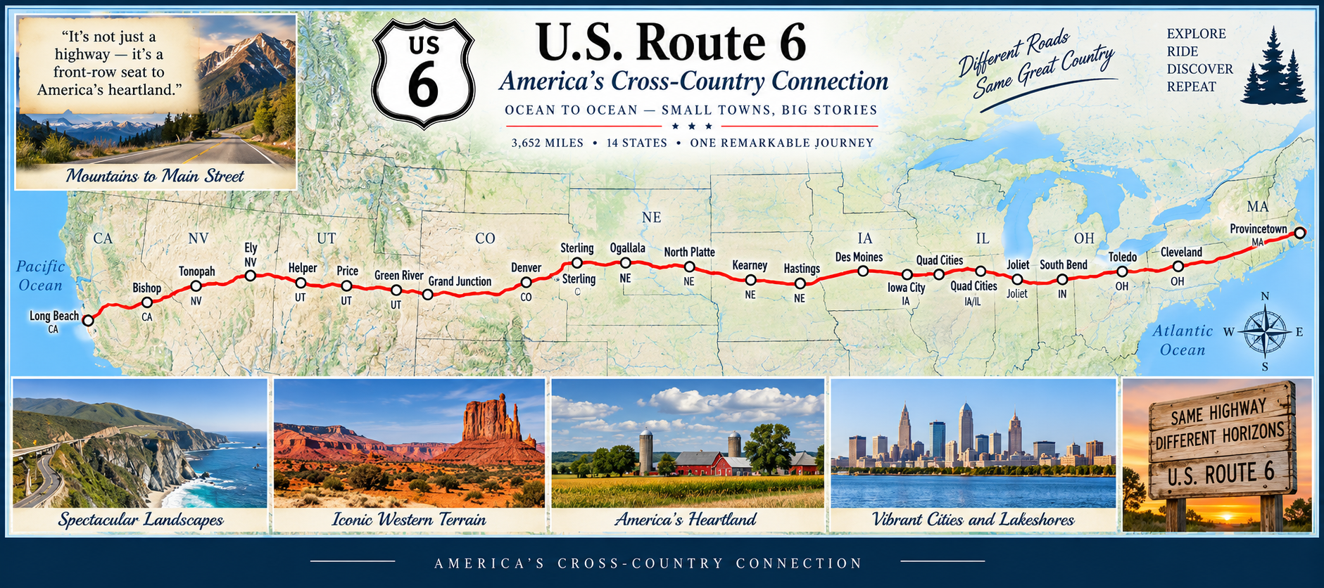
The route crosses New England villages, Pennsylvania hills, Midwestern farmland, the wide plains of Nebraska, the high deserts of Utah, and the dramatic mountain passes of Colorado. Few highways offer such a sweeping look at America’s varied landscapes in a single continuous line.
🛤️ US 9 — The Hudson River & Atlantic Coast Highway
Miles: 523—Status: In Progress
The highway passes colonial towns, Revolutionary War landmarks, rolling farmland, and dense suburban stretches before reaching the Adirondack foothills. Its northern terminus sits just shy of the Canadian border, making US 9 one of the few U.S. routes that feels both coastal and continental.
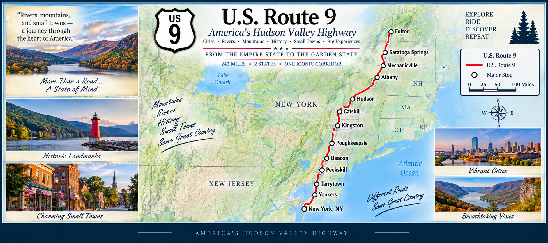
U.S. 9 is a uniquely northeastern highway, running from the coastal towns of Delaware through New Jersey’s shore communities and into the historic Hudson River Valley of New York. It’s a route defined by water — the Atlantic coastline in the south and the Hudson River corridor in the north.
🏞️ US 11 — The Appalachian Valley Highway
Miles: 1,659—Status: In Progress
U.S. 11 is one of the oldest and most historically rich north–south highways in the United States. Running from New Orleans, Louisiana to the Canadian border in New York, it follows the long spine of the Appalachian Valley, paralleling mountain ridges, river valleys, and historic migration routes.
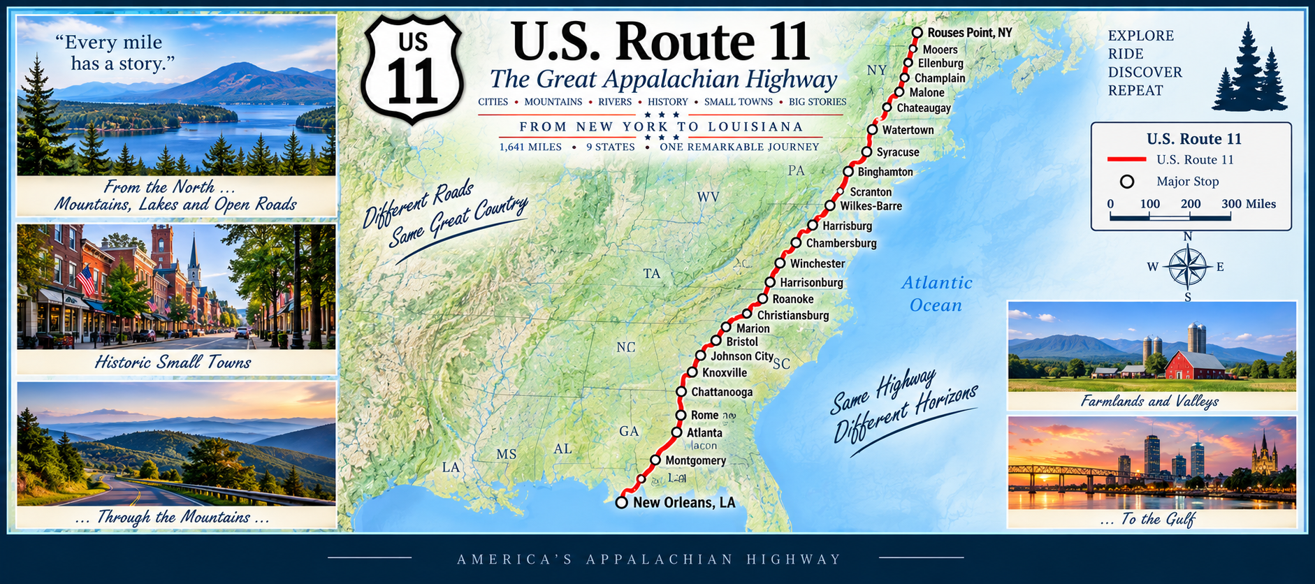
The highway passes through college towns, Civil War sites, rolling farmland, and countless small communities shaped by the geography of the Appalachians. In many places, US 11 runs close to Interstate 81, but it retains the slower pace and character of an older American road.
🏔️ US 14 — The Northern Plains & Yellowstone Highway
Miles: 1,445—Status: In Progress
U.S. 14 begins near Chicago and heads west across the rolling farmland of Wisconsin and Minnesota before entering the wide‑open plains of South Dakota. From there, it climbs into Wyoming’s rugged country, passing through the Bighorn Mountains and entering the eastern gateway of Yellowstone National Park.
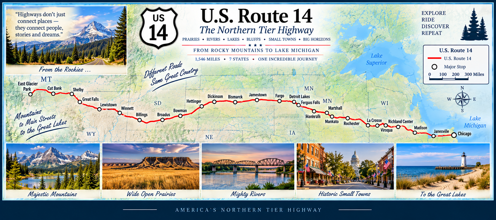
The highway blends quiet Midwestern towns, prairie landscapes, dramatic mountain passes, and some of the most iconic scenery in the American West. US 14 is a route of contrasts — gentle farmland at its start, and towering peaks at its western end.
🌴 US 17 — Florida’s Historic Inland Northbound Route
Miles (Florida): 1,204—Status: In Progress
US 17 begins in Punta Gorda, heading inland almost immediately and leaving the Gulf Coast behind. Early miles pass through Arcadia and quiet ranch country, giving the route a classic old‑Florida feel.
Continuing north, US 17 becomes a major inland corridor through Wauchula, Bowling Green, Fort Meade, Bartow, and Winter Haven. This stretch includes lakes, citrus groves, and historic downtowns.
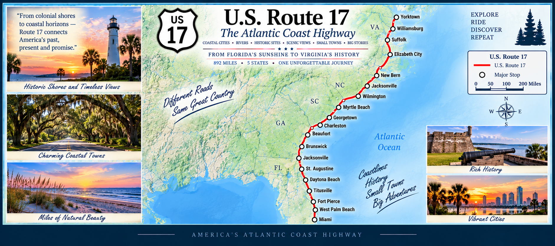
Farther north, the highway enters the Orlando metro, running through Kissimmee and into the city’s southern suburbs. After leaving the metro area, US 17 continues through DeLand, Palatka, and Green Cove Springs, following the St. Johns River region.
The final miles carry US 17 into Jacksonville, where it becomes a major urban route before crossing into Georgia. This completes a full south‑to‑north sweep of inland Florida.
🌊 US 19 — Gulf Coast & Big Bend Highway
Miles (Florida): 1,300—Status: In Progress
US 19 begins at the southern tip of the peninsula in St. Petersburg, crossing the iconic Sunshine Skyway region before heading north along the Gulf Coast. Early miles include Clearwater, Palm Harbor, Tarpon Springs, and other classic west‑coast communities.
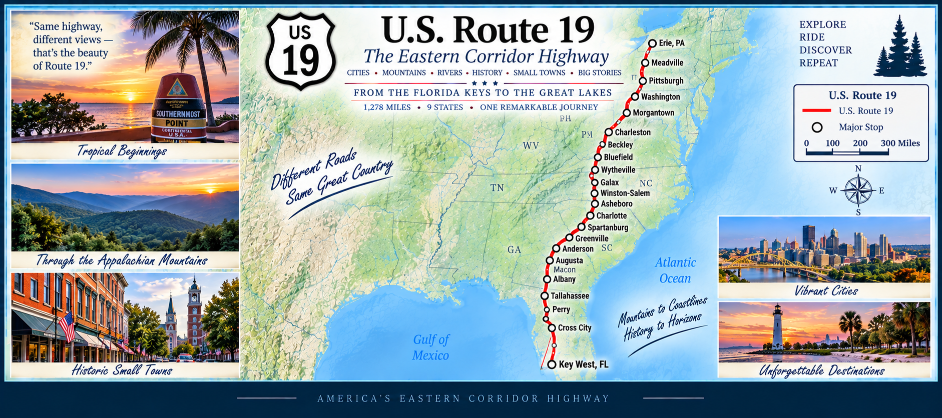
Continuing north, the route becomes more rural as it passes through New Port Richey, Hudson, Spring Hill, and Weeki Wachee. This stretch blends suburban growth with old‑Florida roadside character.
Farther north, US 19 enters Florida’s Nature Coast, traveling through Homosassa, Crystal River, Inglis, Chiefland, Fanning Springs, and Perry. Forests, springs, rivers, and marshlands define this upper section. The highway finishes near the Georgia line, completing a clean south‑to‑north run.
🌾 US 20 — Coast‑to‑Coast Across America’s Northern Tier
Miles: 3,190—Status: In Progress
U.S. 20 is the longest highway in the United States, stretching from the Pacific coastline in Newport, Oregon all the way to the historic streets of Boston, Massachusetts. It crosses deserts, plains, mountains, farmland, and some of the most iconic national parks in the country.
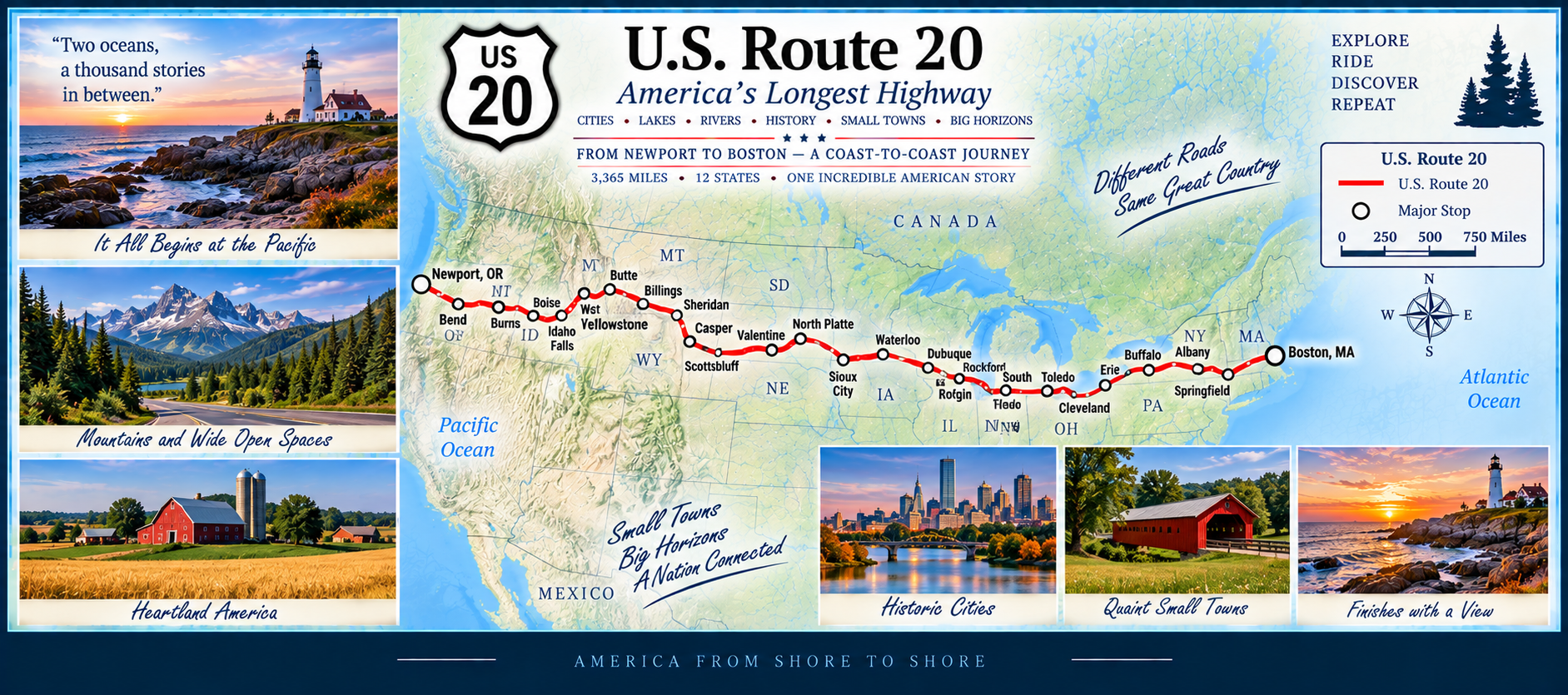
The route climbs over the Cascades, crosses Idaho’s high desert, threads through Yellowstone National Park, spans the wide plains of Nebraska and Iowa, and then enters the industrial heartland of the Midwest. From there, it continues through New York’s Finger Lakes and into New England’s colonial towns before reaching the Atlantic Ocean.
🌲 US 23 — Appalachia to the Great Lakes
Miles: 1,409—Status: In Progress
U.S. 23 begins in the flatlands of northern Florida and heads north through Georgia before entering the Appalachian foothills. It winds through eastern Tennessee and Kentucky, following river valleys and mountain ridges that define the region.
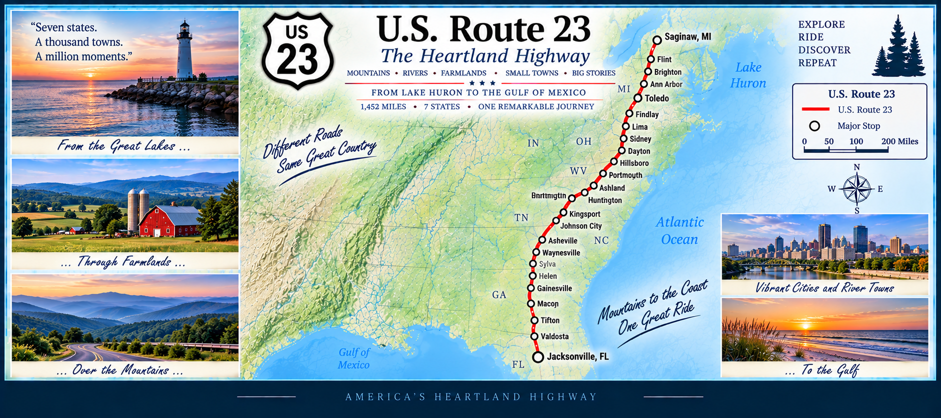
Crossing into Ohio, the highway becomes a major north–south corridor, connecting Columbus with Toledo. From there, US 23 continues into Michigan, passing through Ann Arbor and reaching the Lake Huron shoreline near Standish. It’s a route of dramatic transitions — from southern pine forests to Appalachian hills to Great Lakes country.
🌾 US 27 — The Inland Spine of Florida
Miles (Florida): 1,256—Status: In Progress
Starting in Miami, US 27 heads northwest through the Everglades edge, quickly transitioning from dense urban traffic to wide, open inland scenery. This early stretch highlights the contrast between coastal South Florida and the quiet interior.
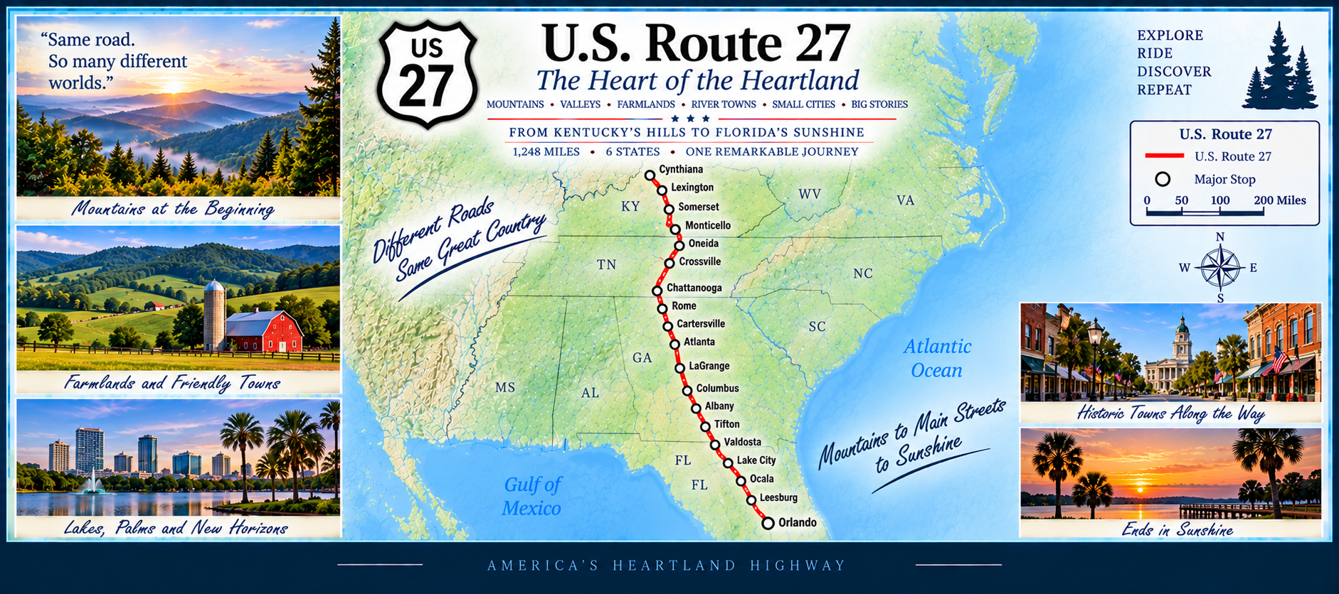
Continuing north, US 27 becomes Florida’s major inland corridor, passing through South Bay, Clewiston, Moore Haven, and Lake Placid. The route skirts the western side of Lake Okeechobee and moves into citrus country, with groves and rolling hills defining the landscape.
Farther north, US 27 climbs into the Lake Wales Ridge, one of Florida’s most unique geological features. The highway then enters the busy Clermont–Leesburg region before continuing through Ocala, High Springs, and Branford. The final stretch carries US 27 through forested terrain toward the Georgia line.
🛤️ US 30 — The Lincoln Highway Corridor
Miles: 3,109—Status: In Progress
US 30 carries a remarkable piece of American road history. Much of its route follows or parallels the historic Lincoln Highway, America’s first transcontinental automobile highway. Established in 1913, the Lincoln Highway stretched from Times Square in New York City to Lincoln Park in San Francisco. When America adopted its numbered highway system in the 1920s, nearly two-thirds of the Lincoln Highway became part of US 30.
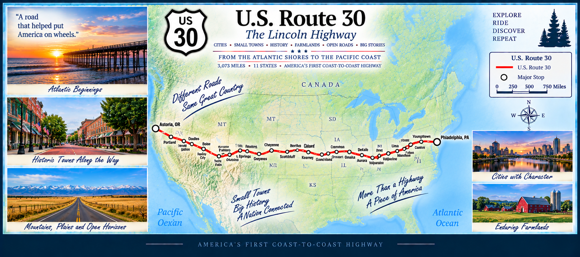
The highway crosses deserts, mountains, plains, and major cities. It passes through Idaho’s Snake River Valley, Wyoming’s high country, Nebraska’s prairie, Iowa’s rolling farmland, and the industrial heartlands of Illinois, Indiana, and Ohio. Continuing east, US 30 enters Pennsylvania and New Jersey, ending near the Atlantic Ocean. It’s one of the most diverse coast‑to‑coast corridors in the United States.
🌄 US 33 — The Appalachian Ridge Runner
Miles: 729—Status: In Progress
U.S. 33 begins in northern Ohio and heads southeast through Columbus before entering the foothills of West Virginia. Once it reaches the Appalachians, the highway becomes a winding, climbing, descending ridge‑runner — full of sharp turns, river valleys, and mountain passes.
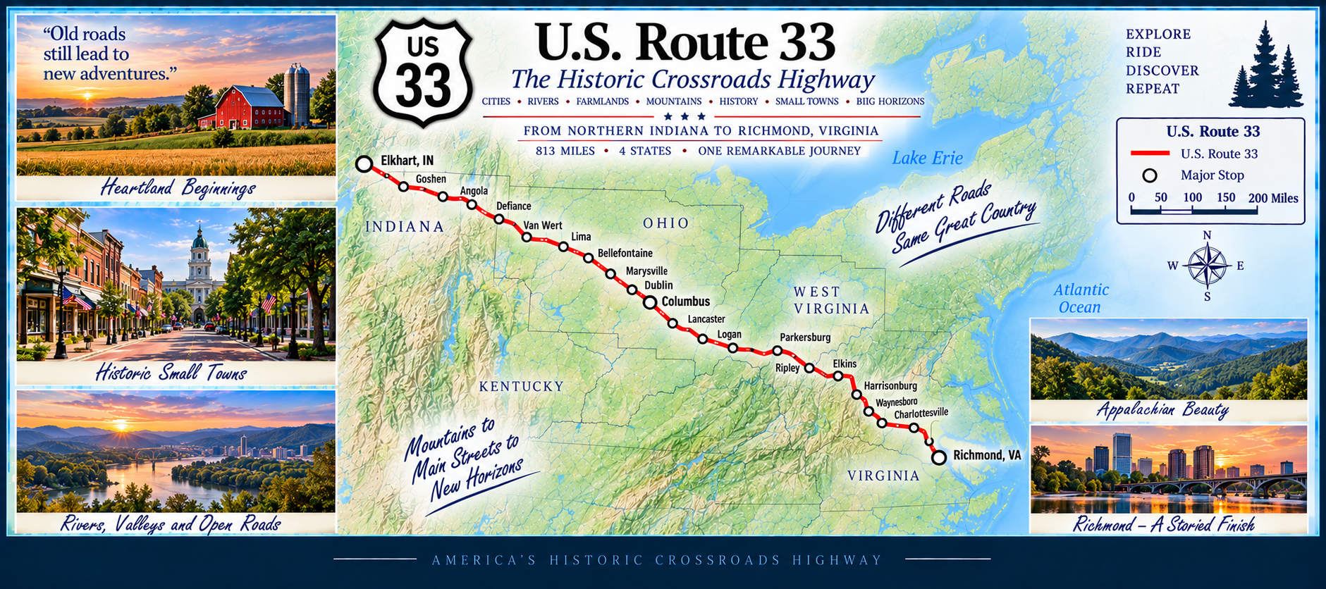
Crossing into Virginia, US 33 continues through the Shenandoah Valley and over the Blue Ridge Mountains, ending near Richmond. Despite its shorter length, the route delivers some of the most dramatic elevation changes and scenic mountain travel in the eastern United States.
⛰️ US 34 — Plains to the Continental Divide
Miles: 1,182—Status: In Progress
U.S. 34 begins in the Rocky Mountains of Colorado, climbing through Estes Park and entering Rocky Mountain National Park via Trail Ridge Road — the highest continuous paved highway in the United States. This stretch delivers extreme elevation, alpine tundra, and sweeping views across the Continental Divide.
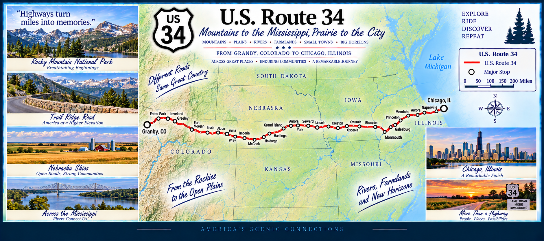
Leaving the mountains, US 34 drops into the plains and becomes a classic midwestern corridor through Nebraska, Iowa, and Illinois. It passes farmland, river valleys, and small towns before ending near Chicago. The route is a dramatic blend of high‑altitude challenge and long, quiet prairie travel.
🌾 US 36 — The Heartland Plains Highway
Miles: 1,414—Status: In Progress
U.S. 36 begins in the Rocky Mountain foothills of Colorado and heads east across the wide plains of Kansas, following a straight, quiet corridor through farmland and small towns. It continues into Missouri, passing near Hannibal — the boyhood home of Mark Twain — before crossing the Mississippi River.
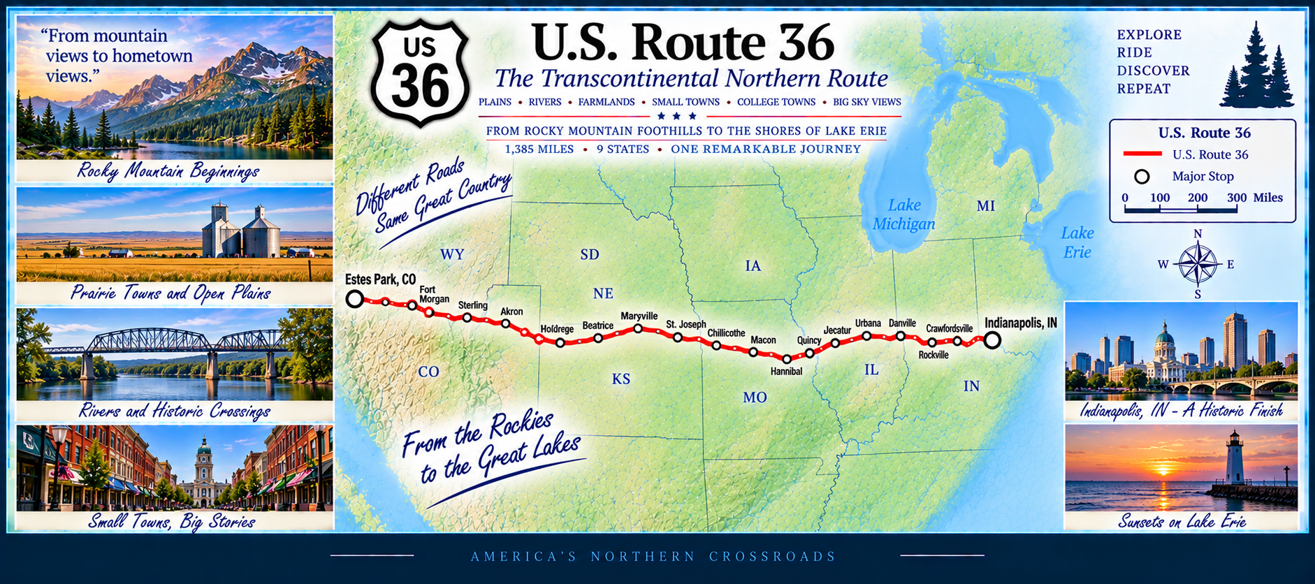
From Illinois into Ohio, the highway becomes more suburban and industrial, eventually reaching the Columbus region. US 36 is a classic midwestern route: long horizons, agricultural landscapes, and steady east–west travel across the center of the country.
🌅 US 43 — The Tennessee River & Deep South Corridor
Miles: 361—Status: In Progress
U.S. 43 begins near the Gulf Coast in Mobile and heads north through rural Alabama, passing pine forests, farmland, and small towns. The highway serves as a major north–south corridor through the western part of the state, connecting communities that sit far from the interstate system.
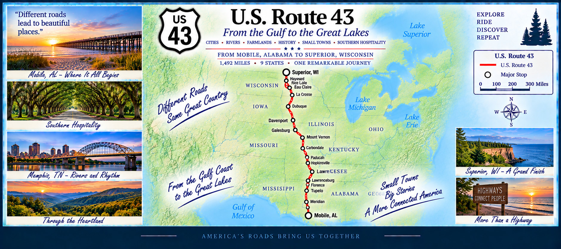
Near the Tennessee River, US 43 enters Florence and Muscle Shoals — a region famous for its music history. From there, the route continues into Tennessee, ending near Columbia. Despite its moderate length, US 43 blends coastal lowlands, river scenery, and historic towns into a steady Deep South journey.
🌞 US 49 — The Mississippi Delta & Pine Hills Highway
Miles: 610—Status: In Progress
U.S. 49 begins near the Mississippi Gulf Coast and heads northwest through Hattiesburg and Jackson, serving as one of the state’s major north–south corridors. The highway crosses pine forests, rolling hills, and long stretches of rural countryside.
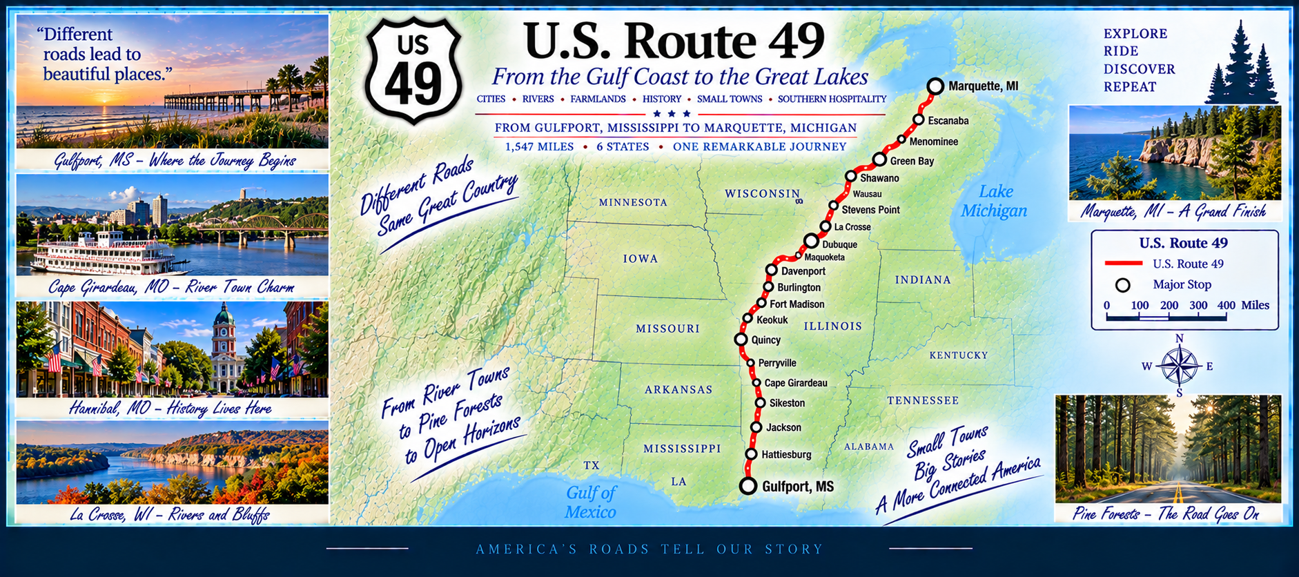
North of Jackson, US 49 enters the Mississippi Delta, where the landscape becomes flat, open, and agricultural. The route passes through historic towns shaped by blues culture and river commerce before reaching the Arkansas border. Despite its moderate length, US 49 delivers a mix of terrain — from coastal lowlands to Delta farmland to gentle uplands.
🛣️ US 60 — Atlantic Shores to the Desert Southwest
Miles: 2,464—Status: In Progress
U.S. 60 begins at the edge of the Atlantic Ocean in Virginia Beach and heads west across the Appalachian Mountains, passing through historic towns, river valleys, and the rolling hills of Kentucky. It’s a route that blends eastern heritage with the open horizons of the American interior.
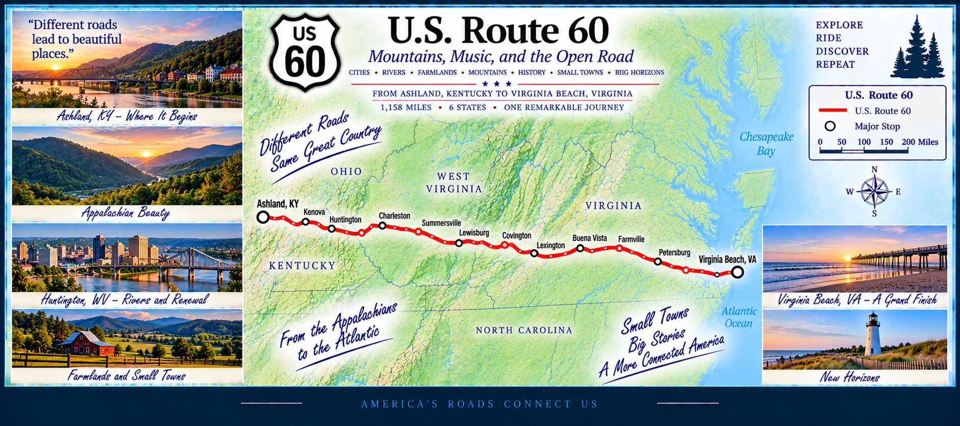
Continuing west, US 60 crosses Missouri and Oklahoma, where it overlaps portions of the legendary Route 66. From there, the highway enters Texas and New Mexico, transitioning into high‑desert landscapes, mesas, and wide‑open skies.
The final miles carry US 60 into Arizona, where it winds through rugged terrain toward the Superstition Mountains and the desert approaches to Phoenix. Few highways offer such a coast‑to‑desert transformation in a single continuous line.
🎷 US 61 — The Mississippi River Blues Highway
Miles: 1,154—Status: In Progress
U.S. 61 begins in New Orleans and follows the Mississippi River north through Baton Rouge and Natchez, passing through the heart of blues country. The highway continues into Mississippi and Tennessee, connecting historic towns, river bluffs, and agricultural landscapes shaped by the Delta.
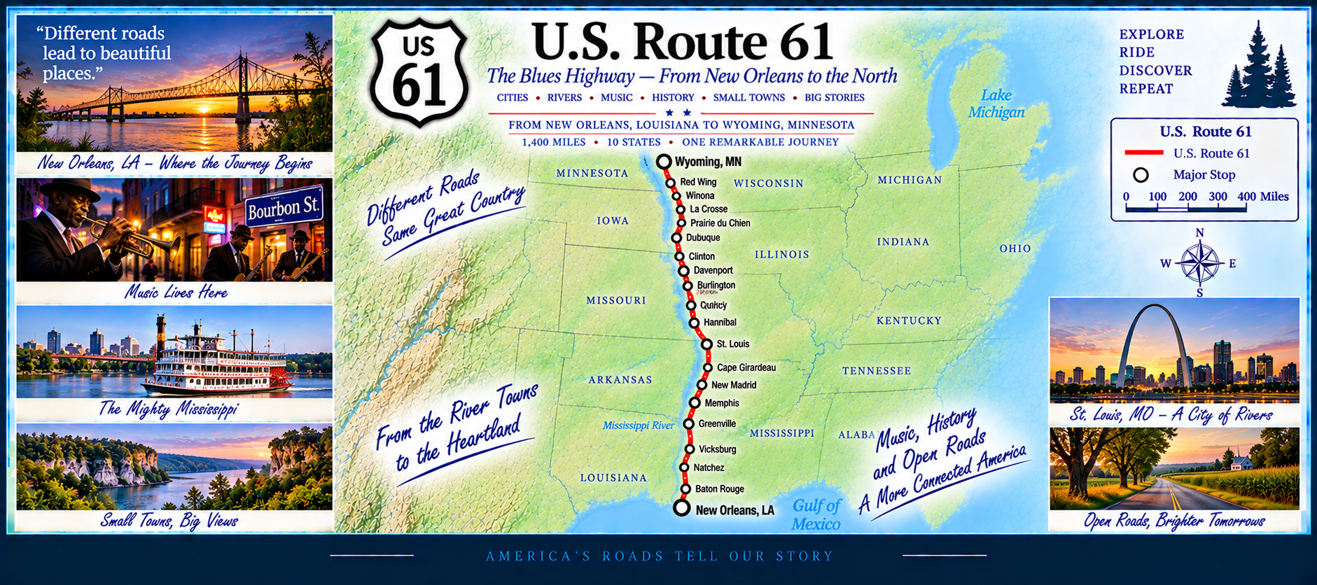
North of Memphis, US 61 becomes a major corridor through Missouri and Iowa, running close to the river before entering Minnesota. It passes through the Twin Cities and continues toward Duluth, ending near Lake Superior. The route blends music history, river scenery, farmland, and northern forests into one long north–south journey.
🏜️ US 62 — Borderlands, Plains & Ozarks Highway
Miles: 1,873—Status: In Progress
U.S. 62 begins at the Mexican border in El Paso, Texas, making it one of the few US-numbered highways with an international gateway. From there, it travels through desert basins, high plains, and the rolling grasslands of New Mexico and Texas.
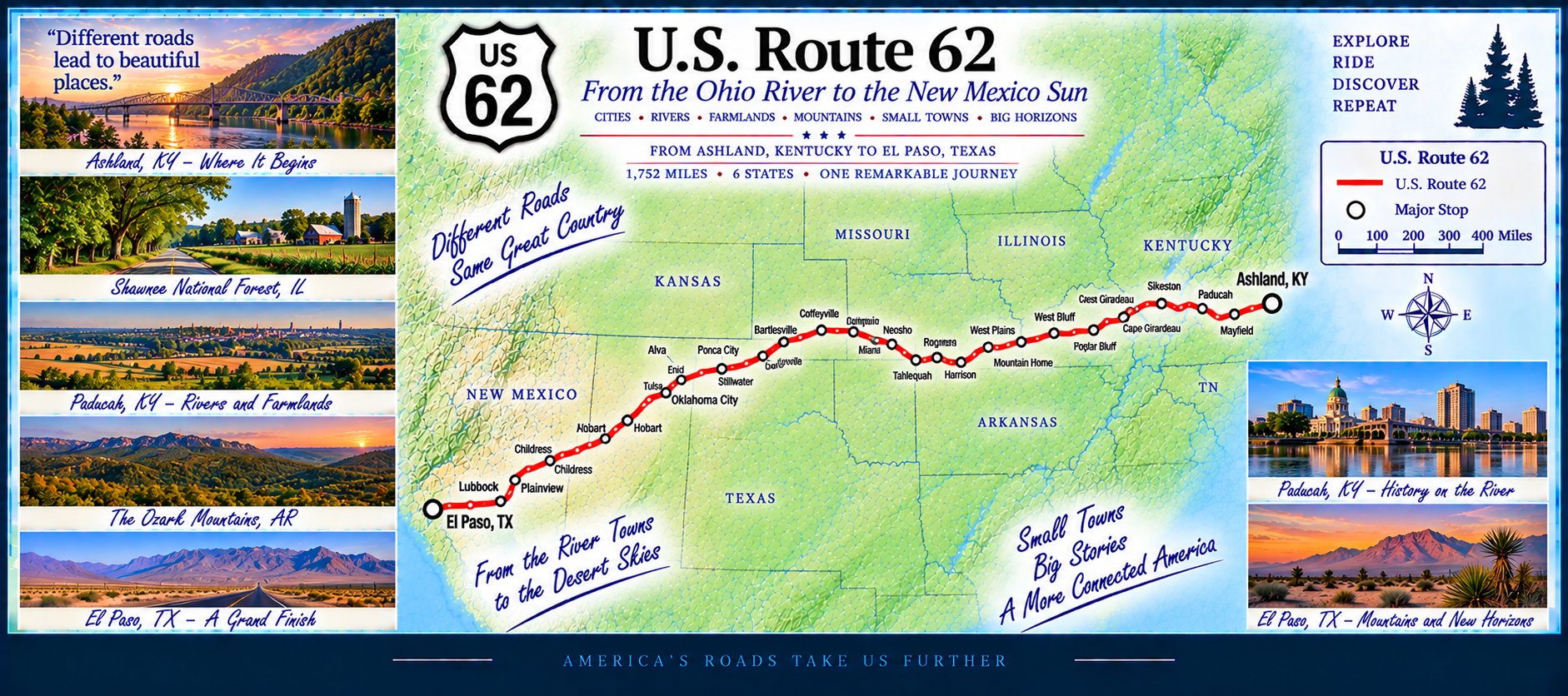
Entering Oklahoma and Arkansas, US 62 climbs into the Ozarks, passing through forested hills, river valleys, and historic towns. The route continues east into Kentucky, crossing the Ohio River and entering the Appalachian foothills.
In its final stretch, US 62 travels through Ohio, Pennsylvania, and New York, ending at Niagara Falls. Few US routes offer such a dramatic transition from desert borderlands to one of the most famous waterfalls in the world.
🌄 US 64 — Plains, Ozarks & Appalachian Gateway Highway
Miles: 2,169—Status: In Progress
U.S. 64 begins near the Arizona–New Mexico border region and heads east across the high plains of Oklahoma. The western portion features wide‑open landscapes, long straight stretches, and classic prairie scenery.
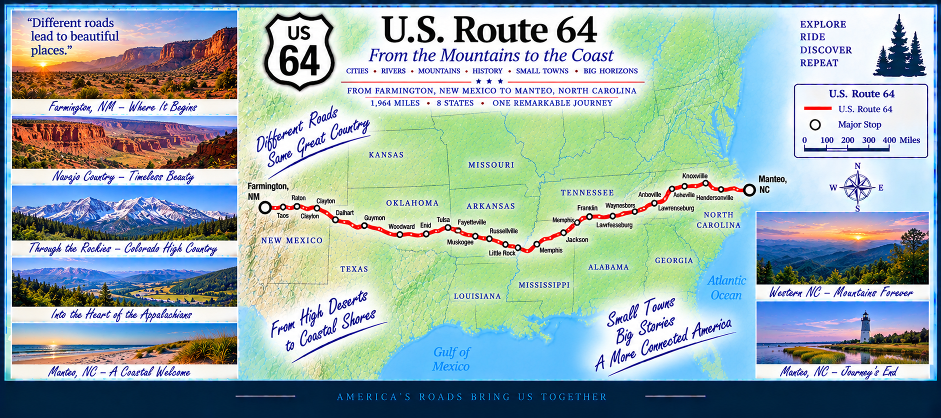
Entering Arkansas, US 64 climbs into the Ozarks, passing through river valleys, forested hills, and historic small towns. The route continues into Tennessee, connecting Memphis, Jackson, and the Nashville region before crossing the Cumberland Plateau and entering the Appalachian foothills.
In North Carolina, US 64 becomes a major east–west corridor, running through the Piedmont and coastal plains. It ends near the Outer Banks, making it one of the few US routes to span from desert‑edge terrain to Atlantic‑coast lowlands.
🌟 US 66 — The Mother Road
Miles: 2,452—Status: In Progress
U.S. 66 is the most legendary highway in America — the Mother Road. Running from Chicago to Santa Monica, it carried generations of travelers westward, becoming a symbol of freedom, migration, and the open road. Even though it was officially decommissioned in 1985, its cultural footprint remains enormous.
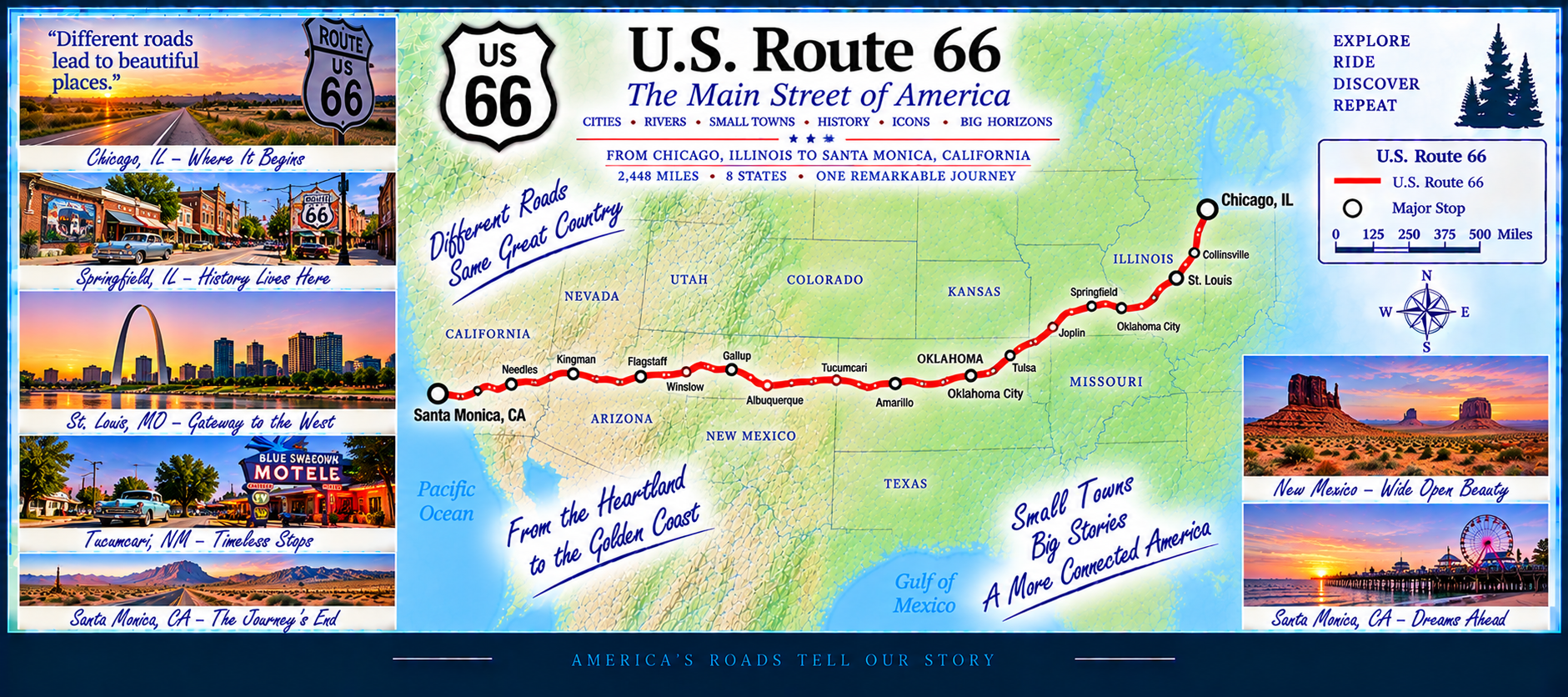
The route crosses Midwestern farmland, the plains of Oklahoma, the high desert of New Mexico, the red rock country of Arizona, and the Mojave Desert before reaching the Pacific Ocean. Along the way are classic diners, neon signs, vintage motels, and preserved stretches of original pavement — reminders of a golden age of travel.
🐎 US 68 — The Bluegrass & River Valley Highway
Miles: 419 (short but scenic)—Status: In Progress
U.S. 68 begins in western Kentucky near the Land Between the Lakes region and travels east through rolling farmland, river valleys, and historic small towns. The route passes through Hopkinsville, Bowling Green, and the heart of Kentucky’s Bluegrass country.
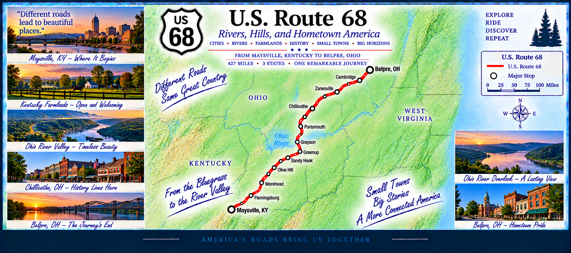
Continuing northeast, US 68 crosses the Kentucky River near Lexington and heads toward Maysville, where it enters Ohio. Despite its shorter length, the highway delivers a mix of rural charm, college‑town energy, and classic Bluegrass scenery.
🌵 US 70 — Desert, Plains & Southern Heartland Highway
Miles: 2,477—Status: In Progress
U.S. 70 begins in eastern Arizona and travels across the deserts and high plains of New Mexico and Texas. The western half of the route features wide‑open landscapes, mesas, and long stretches of rural highway that reflect its early transcontinental heritage.
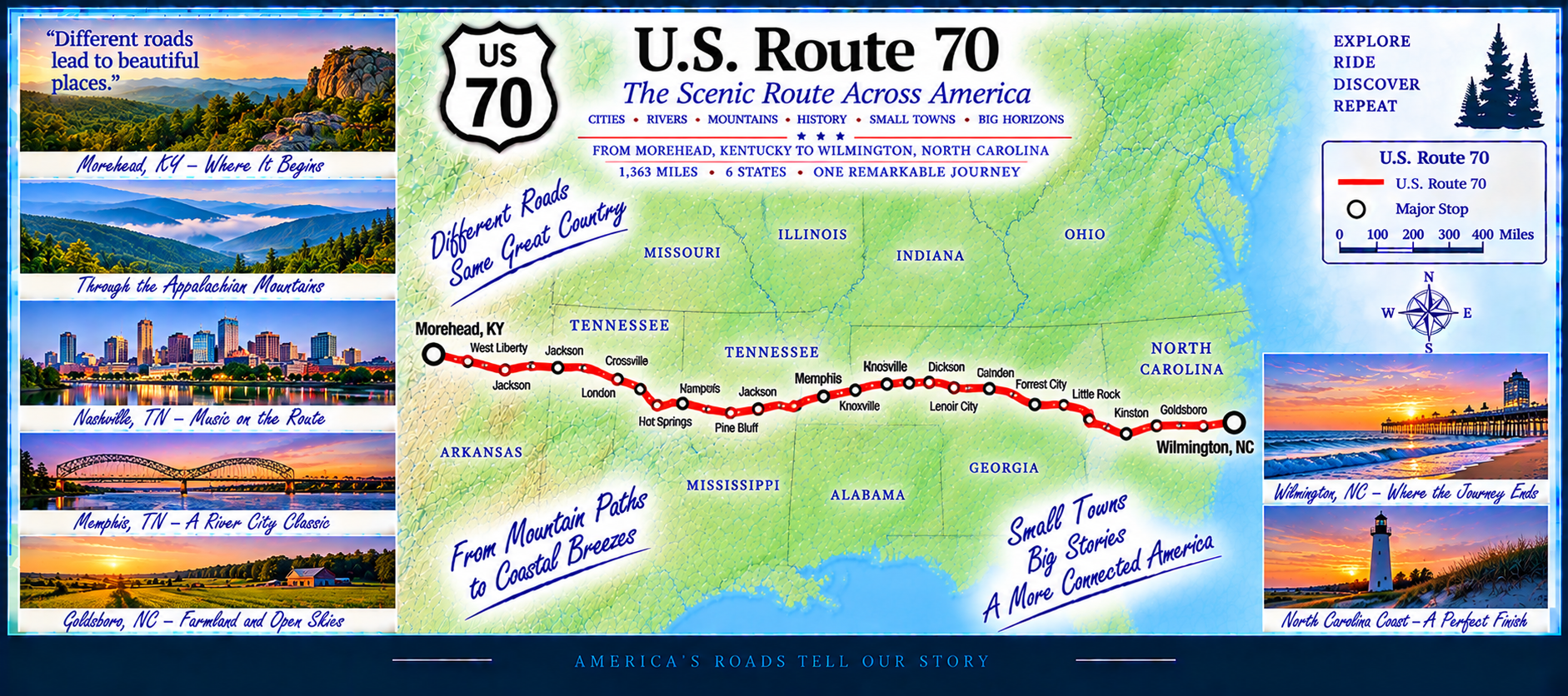
Entering the South, US 70 passes through Oklahoma and Arkansas before crossing the Mississippi River into Tennessee. From Memphis to Nashville to Knoxville, the route becomes a major east–west corridor. Continuing into North Carolina, US 70 winds through the Piedmont and coastal plains, ending near the Atlantic Ocean.
🌾 US 79 — The Southern Heartland Diagonal
Miles: 1,256—Status: In Progress
U.S. 79 begins in the pine forests of eastern Texas and heads northeast through Louisiana, crossing bayous, farmland, and small towns. Entering Arkansas, the route becomes a mix of agricultural landscapes and rolling hills as it approaches the Mississippi River region.
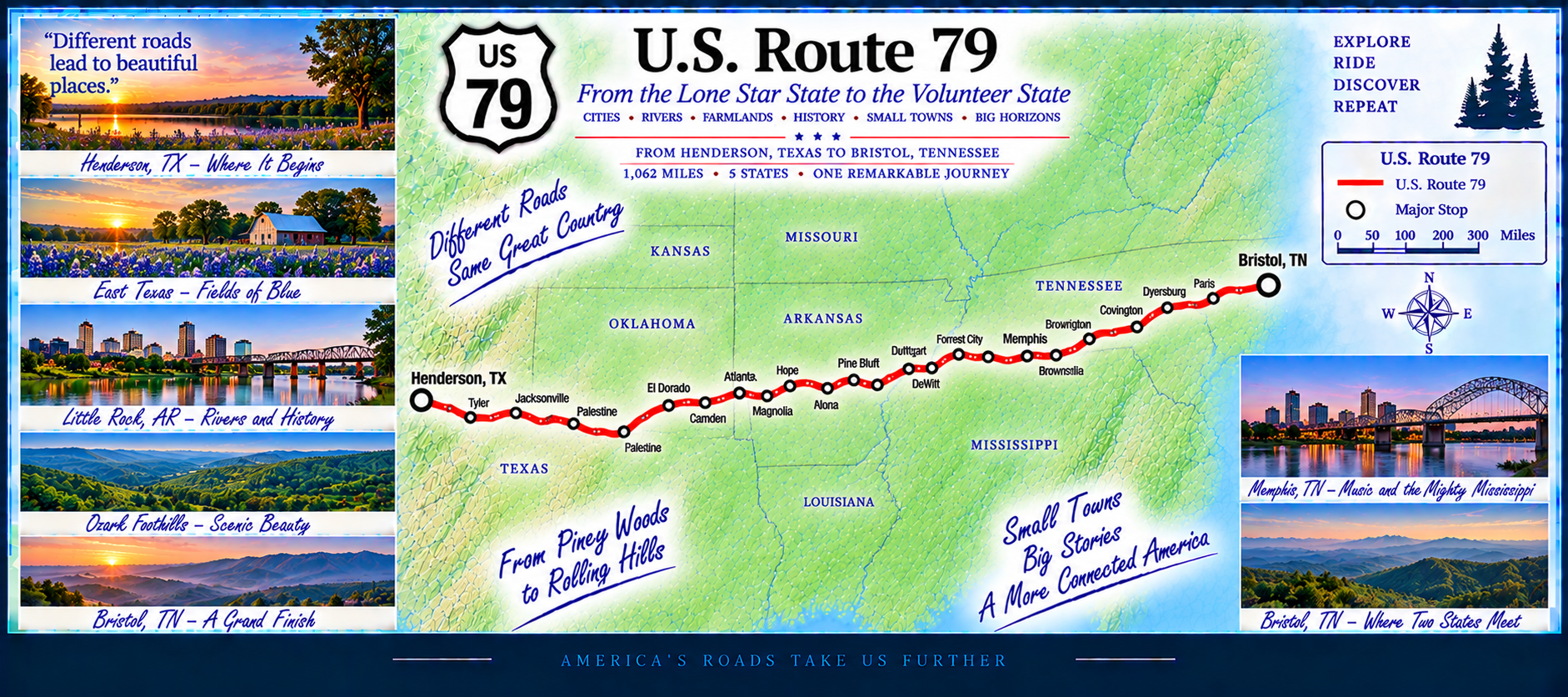
Continuing into Tennessee and Kentucky, US 79 passes through Clarksville and the Land Between the Lakes area, ending near the Tennessee River. It’s a diagonal southern route defined by quiet scenery, rural communities, and steady travel across the heartland.
🌅 US 80 — East to West
Miles: 2,059 — Status: In Progress
U.S. 80 begins on the Atlantic shore at Tybee Island, Georgia, and stretches westward across the Deep South, the deserts of Texas and New Mexico, and the mountains of Arizona before reaching the Pacific coast in San Diego, California.
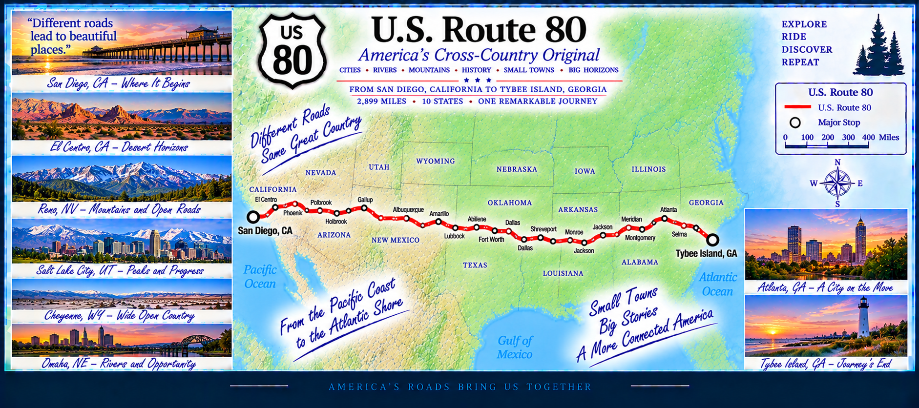
Known as the “Broadway of America,” this historic route once linked the nation’s two great oceans. Today, it captures the spirit of cross‑country travel — from southern hospitality to western adventure — tracing a path through history, culture, and open horizons.
🏜️ US 85 — High Plains to the Southwest
Miles: 1,297—Status: In Progress
U.S. 85 begins at the Canadian border in North Dakota and heads south through the wide‑open plains of the Dakotas. It passes near the Black Hills and the Badlands, offering some of the most dramatic scenery in the northern Great Plains.
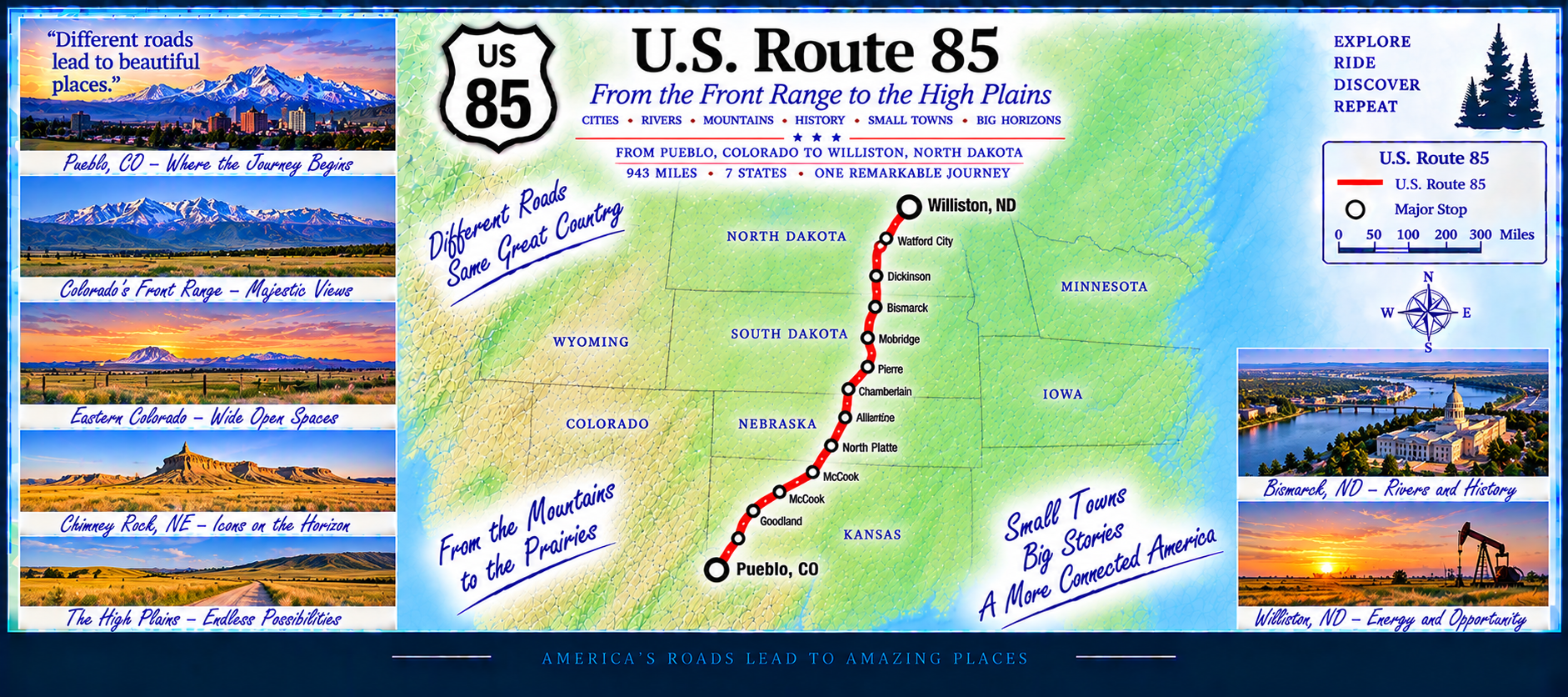
Continuing into Wyoming and Colorado, the highway becomes a mix of rural stretches and growing Front Range communities. South of Denver, US 85 follows historic corridors toward New Mexico, eventually reaching the desert landscapes near the Mexican border. It’s a route defined by long horizons, rugged terrain, and quiet western towns.
🌴 US 90 — Gulf Coast & Southern Heartland Highway
Miles: 1,698—Status: In Progress
U.S. 90 is one of the great southern highways, running close to the Gulf of Mexico and weaving through historic towns, bayous, pine forests, and coastal plains. It begins in West Texas and travels east through Louisiana, Mississippi, Alabama, and the Florida Panhandle before reaching Jacksonville.
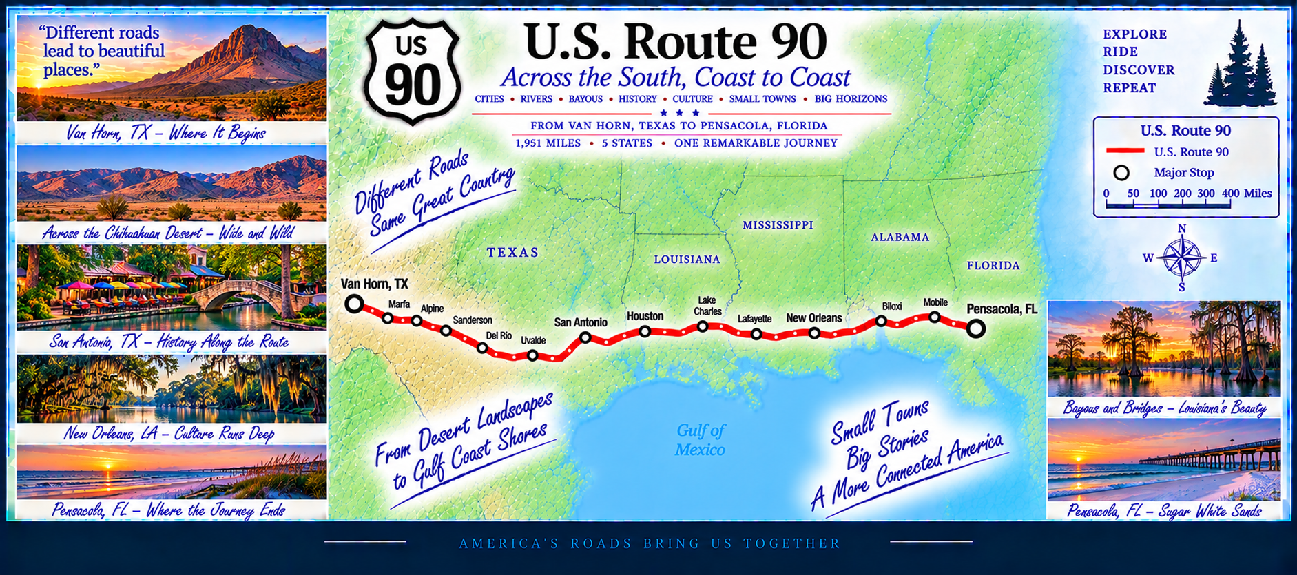
The route passes through iconic southern landscapes — Cajun country, Mobile Bay, the white‑sand beaches of the Gulf Coast, and the longleaf pine ecosystems of northern Florida. US 90 often parallels Interstate 10, but it retains the charm, history, and slower pace of an older American highway.
🌊 US 101 — The Pacific Coast Highway
Miles: 1,536—Status: In Progress
U.S. 101 is one of the most scenic highways in America, running along the Pacific coastline through California, Oregon, and Washington. From Los Angeles to the Olympic Peninsula, it passes beaches, cliffs, redwood forests, coastal towns, and major cities like San Francisco and Seattle.
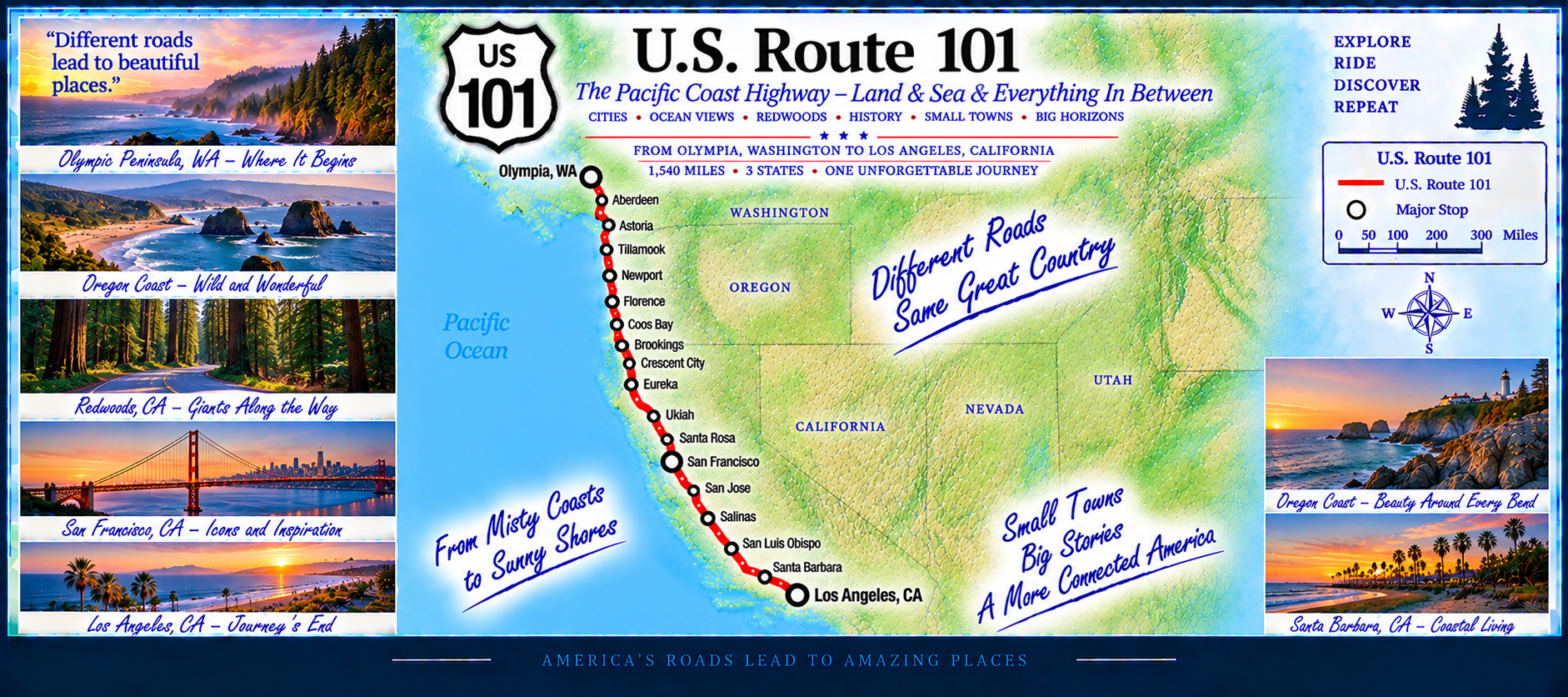
The route includes legendary stretches such as the Golden Gate Bridge, Big Sur, the Oregon Coast, and the rainforest edges of the Olympic Peninsula. US 101 blends ocean views, rugged terrain, and historic communities into one continuous coastal journey.
🌾 US 301 — Florida’s Inland Heritage Highway
Miles (Florida): 1,349—Status: In Progress
US 301 begins on Florida’s Gulf Coast in Sarasota, heading inland almost immediately. Leaving the beaches behind, the route transitions into quiet farmland, ranch country, and small towns that reflect old‑Florida character.
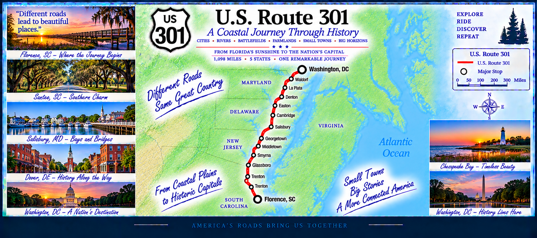
Continuing north, US 301 passes through Parrish, Ellenton, and Palmetto before entering the Tampa Bay region. The highway then moves into rural interior Florida, traveling through Dade City, Zephyrhills, and Ridge Manor.
Farther north, US 301 becomes a major inland corridor through Ocala, Citra, Hawthorne, Waldo, Starke, and Baldwin. This stretch is known for forests, lakes, and long straightaways. The route finishes near the Georgia line, completing a clean south‑to‑north run through the peninsula.
🌴 US 41 — The Tamiami Trail & Gulf Coast Highway
Miles (Florida): 1,359—Status: In Progress
Beginning in Miami, US 41 immediately enters one of Florida’s most iconic stretches: the Tamiami Trail, a long, straight run across the Everglades. This segment blends sawgrass marshes, wildlife crossings, and classic roadside stops that define old‑Florida travel.
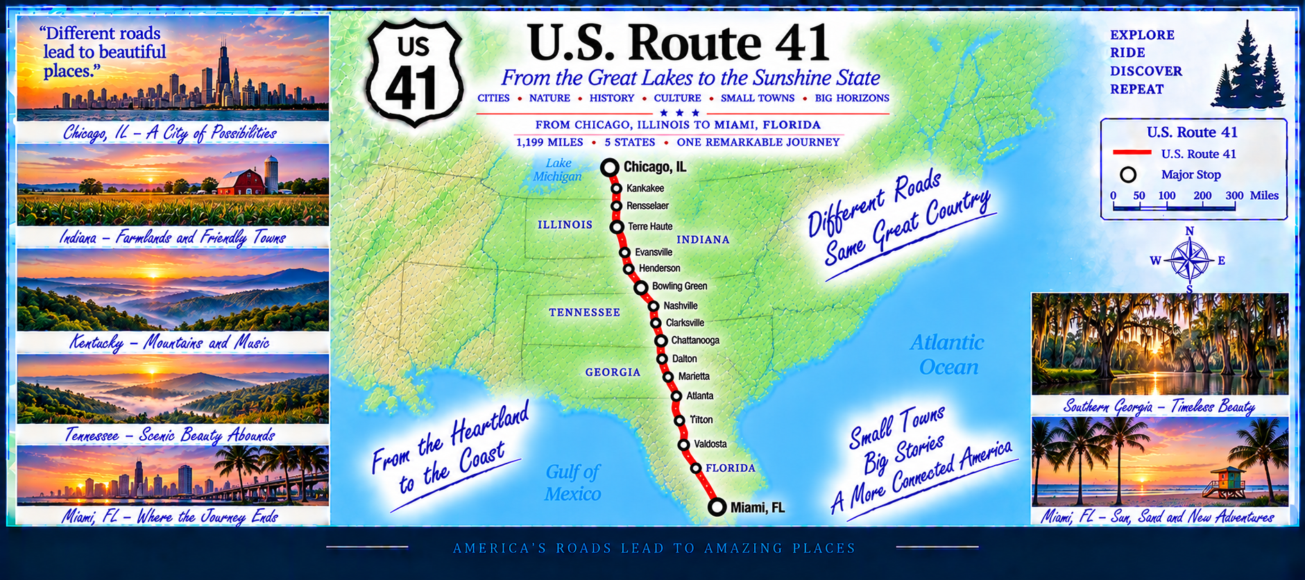
Reaching the Gulf Coast, US 41 becomes a major northbound corridor through Naples, Fort Myers, Port Charlotte, Sarasota, and Tampa. The route shadows the shoreline, passing beaches, mangroves, and historic downtowns.
Continuing north, US 41 travels through Brooksville, Inverness, Dunnellon, Williston, and Lake City before crossing into Georgia. This upper stretch shifts from coastal scenery to rolling inland forests and small towns, completing a full south‑to‑north sweep of the peninsula.
🌿 US 441 — Lake Country & Inland Florida Highway
Miles (Florida): 622—Status: In Progress
US 441 begins in Miami, running northwest through the urban core before transitioning into quieter inland scenery. Early miles include Hollywood, Fort Lauderdale, and Boca Raton, forming a major northbound spine through South Florida.
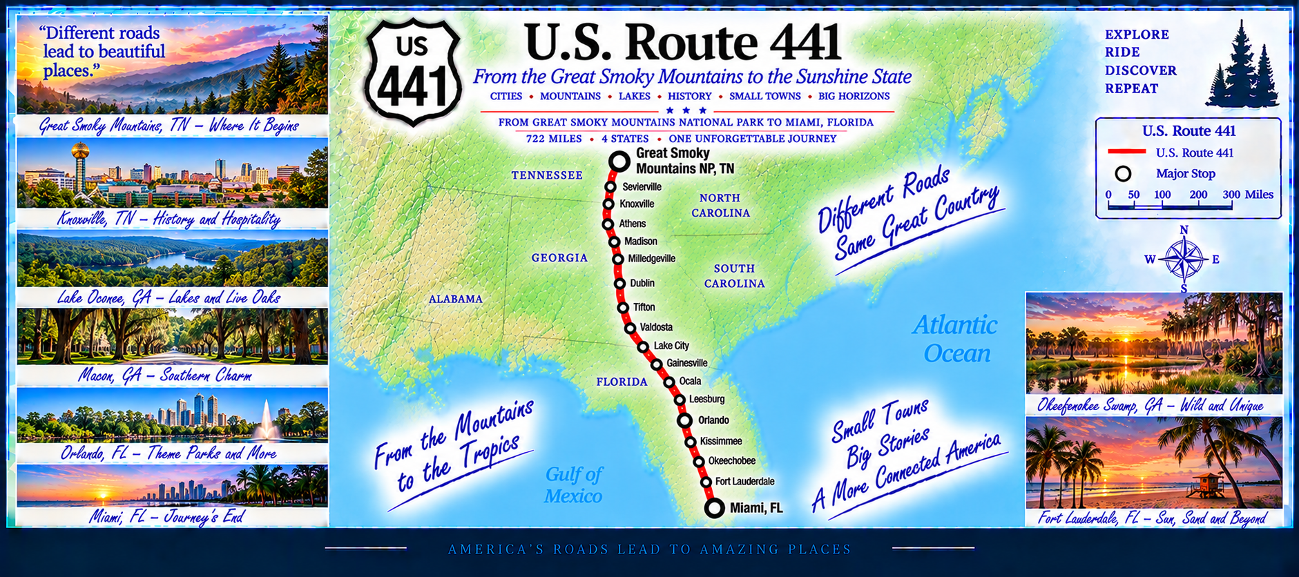
Continuing north, the highway enters Florida’s Lake Country, passing through Wellington, Royal Palm Beach, Belle Glade, and Pahokee. The route skirts the eastern side of Lake Okeechobee, offering wide views of the lake and surrounding farmland.
Farther north, US 441 becomes a major inland corridor through Okeechobee, Yeehaw Junction, Holopaw, and St. Cloud. Entering the Orlando region, it travels through Kissimmee and into the city’s southern suburbs.
Beyond Orlando, US 441 continues through Apopka, Mount Dora, Eustis, Leesburg, Belleview, and Ocala. The final stretch carries the route through High Springs, Lake City, and into forested terrain before crossing into Georgia.